


Download software tagged by map diagrams
|
The most popular program: Quick Slide Show 2.00

more info |
|
We recommend: Image Broadway 5.0
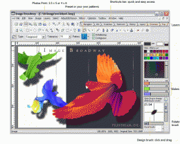
more info |
Animated States and Capitals 1.0 by Flix Productions
2005-10-25
Learn the U.S. states and capitals in a fun (and funny) way. A full screen clickable map of the U.S. is used to teach names and locations of states and capitals in a variety of ways. Completion of 10 problems is rewarded with a silly animation.
StarStrider 2.7 by FMJ-Software
2005-10-25
StarStrider is a software planetarium that utilizes the latest in 3D-technology in order to show you not only the planets and satellites of our solar system, but also galaxies, nebulas, and hundreds of thousand of stars - in real-time 3D.
World time 1.0 by FreeShareware
2005-10-25
1. Unlimited configurable clocks, each with it's own time zone.
2. A 2D or 3D world map capable of plotting any location by Lat/Long and displaying the part of the globe currently in darkness (night).
3. Unlimited user definable alarms.
Geo Log Analyzer 1.2 by Altstone Software
2005-10-25
Use this unique e-marketing tool to visually represent geo-targeting data obtained from web server log analysis. See your visitors on the world map. Optimize web site costs and bring more customers to your web-enterprise! Download FREE trial today!
SplineCalc 4.3.2 by GeoSpline.com
2005-10-25
SplineCalc is multipurpose scientific calculator for implementation of various mathematical operations with maps (grids), data tables, lines, polygons (including multiply connected) and numbers. It can be useful for hard scientist or Surfer users.
The Collectors Crown 4.5.11 by Gerribert Software
2005-10-25
A database for discerning collectors of Aniques, Art, Books, Coins, Maps, Notes, Stamps, Videos, CD's, DVD's or Photos, that has a very attractive graphical interface, that may be customized. Various reports are available, as is a slideshow etc.
GIS ObjectLand 2.6.3 by Radom-T
2005-10-25
GIS ObjectLand is a universal Geographic Information System for Windows. Key features: vector-raster maps; multiuser data editing; import/export for MIF/MID, SHP, DXF, DBF, CSV; access permissions for users; using other DBMS (ODBC); COM interfaces.
Universal Desktop Ruler 2.5 by AVPSoft
2005-10-26
It allows you to measure not only a straight line distance but any curved distance on the Screen. It allows you to measure quickly and accurately distances, areas and perimeters of figures on the screen.
Bersoft Image Measurement 4.02 by Bersoft Inc.
2005-10-26
Supports image analysis functions: angle, distance, perimeter, area, point and line measurements. Includes pixel profile, array/band analyzer, finding objects, and histogram with statistics. Now also supports DICOM, Photoshop and Photo-CD file.