


Download software tagged by germany
|
The most popular program: Quick Slide Show 2.00

more info |
|
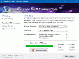
We recommend: ChrisPC Free VPN Connection 1.06.11
more info |
Geodata Germany 24.00 by Killet Software Ing.-GbR
2020-01-01
The database contain geodata of the Federal Republic of Germany with geo referenced towns, municipalities, town quarters, administrative units, postal codes, telephone preselections, nature areas, landscapes, climatic zones for proximity searches ec.
WM2006 Group Tables Screen Saver 1.0 by Peer 2 Bier
2006-05-11
A nice germany world cup 2006 screen saver showing you all group tables of the fifa germany 2006 world cup event.
Soldiers of Empires 1.4 by IgorLab Software
2005-10-26
Soldiers of Empires.
High-detalized turn-based wargame. 1941, East Front. Stalin or Hitler? USSR or Germany?
StampManage Stamp Collecting Software 2010 by Liberty Street Software
2009-12-14
Use StampManage software to catalog and value your stamp collection. Features include 75, 000+ listings of stamps from USA, Canada, Germany, Australia, UN & more, with hi-res images, indexed by the industry-standard SCOTTâ„¢ numbering system
Oleco::NetLCR Pro 2.1.1 by Oleco GmbH
2005-10-27
Oleco is a Least Cost Router for Dial-Up Internet Connections within Germany. Contains all German Access-Providers that donР’Т‘t need registration for Usage.
Oleco::NetLCR 3.00.315 by Oleco GmbH
2005-10-27
Oleco is a Least Cost Router for Dial-Up Internet Connections within Germany. Contains all German Access-Providers that donР’Т‘t need registration for Usage.
LangPad - German Characters 1.1 by WISCO Computing
2005-10-27
LangPad - German Characters provides an easy way to insert German language characters and symbols into your WordPad and Notepad text. Click the mouse on a character or symbol in the chart, and it will be inserted into your text.
Geodaten Deutschland 10.00 by Killet Softwareentwicklung GbR
2006-03-16
Geodata of the Federal Republic Germany with municipalities, postal codes, telephone preselections. Georeferences as Gauss Krueger- UTM- and geographic coordinates. Suitable for branch searches, periphery searches and distance computations.
AnyChart Flash Map Component 5.1.2.5 by AnyChart.Com
2011-05-12
Anychart Flash Maps Flexible XML-Driven solution: US, World, US Counties. You can add background and captions, XML data file and a set of customizable options make AnyChart Maps a universal solution for web developers.