


Download software tagged by free gis sdk
|
The most popular program: Quick Slide Show 2.00

more info |
|
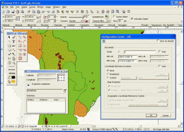
We recommend: Canvas GIS Mapping Edition 9.0.4
more info |
AvisMap GIS Engine 5.0 by AvisMap GIS Technologies
2007-11-07
AvisMap GIS Engine is a comprehensive SDK for the development of custom GIS applications and solutions. This SDK provides several ActiveX (OCX) controls which support Visual Basic, C#, Delphi, Visual C++ and other ActiveX compatible language.
AvisMap GIS Engine 5.0.2 by AvisMap GIS Technologies
2009-11-24
AvisMap GIS Engine is a comprehensive SDK for the development of custom GIS applications and solutions. This SDK provides several ActiveX (OCX) controls which support Visual Basic, C#, Delphi, Visual C++ and other ActiveX compatible language.
SD-TOOLKIT ANPR SDK for Windows 1.1.42 by SD-TOOLKIT
2018-04-11
SD-TOOLKIT License Plate Recognition (ANPR/LPR) SDK. This Royalty free ANPR SDK for Windows allows you to integrate a license plate recognition functionality into various types of software products.
AvisMap Deskpro 5.1.0 by AvisMap GIS Technologies
2009-12-02
AvisMap Desktop Professional 5 is a professional desktop GIS software for map editing, managing, analysis attribute data, aid decision-making transactions and output map, print tables, 3D modeling, and other functions.
Canvas GIS Advanced (Mac) 9.0.4 by ACD Systems
2005-10-26
CANVAS 9 Advanced GIS Mapping Edition: Direct support for Geographic Information System data. You can take measurements in geographic coordinates, import any popular GIS file types into unlimited numbers of automatically aligned overlapping layers.
Canvas GIS Advanced 9.0.4 by ACD Systems
2005-10-26
CANVAS 9 Advanced GIS Mapping Edition includes direct support for Geographic Information System data. Take measurements in geographic coordinates, import any popular GIS file types into unlimited numbers of automatically aligned overlapping layers.
GIS Jobs 4.5.187.4 by GISCrossing
2008-08-05
GIS Jobs toolbar for Internet Explorer. Find GIS jobs and GIS career.
GIS ObjectLand 2.6.3 by Radom-T
2005-10-25
GIS ObjectLand is a universal Geographic Information System for Windows. Key features: vector-raster maps; multiuser data editing; import/export for MIF/MID, SHP, DXF, DBF, CSV; access permissions for users; using other DBMS (ODBC); COM interfaces.
Canvas GIS Mapping Edition (Mac) 9.0.4 by ACD Systems
2005-10-26
CANVAS 9 GIS Mapping Edition includes direct support for Geographic Information System data. You can take measurements in geographic coordinates, import SHAPE & GeoTIFF files into unlimited numbers of automatically aligned overlapping layers.