


Download software tagged by canvas
|
The most popular program: Quick Slide Show 2.00

more info |
|
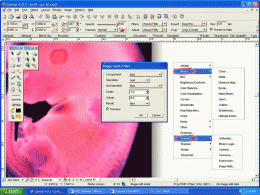
We recommend: Canvas Scientific Imaging Edition (Mac) 9.0.4
more info |
Canvas Painting 101 1.0 by Make Extra Money
2008-07-21
Canvas Painting 101! Beginners Guide To Canvas Painting. With colors and design you can express every emotion you feel.
Photos On Canvas Print calculator 1.00 by Magnipic
2008-09-06
Photos on Canvas Printing quality Calculator - use this completely FREE, slick, elegant solution in order to calculate the quality you will get when printing your digital pictures on canvas. According to target size, calculate the resulting quality.
Canvas Scientific Imaging Edition 9.0.4 by ACD Systems
2005-10-26
CANVAS 9 Scientific Imaging Edition blends native support for advanced imaging and DICOM support with Canvas' full range of vector illustration, image editing, page layout, web graphics, and desktop presentation features.
Canvas GIS Mapping Edition (Mac) 9.0.4 by ACD Systems
2005-10-26
CANVAS 9 GIS Mapping Edition includes direct support for Geographic Information System data. You can take measurements in geographic coordinates, import SHAPE & GeoTIFF files into unlimited numbers of automatically aligned overlapping layers.
Canvas GIS Mapping Edition 9.0.4 by ACD Systems
2005-10-26
CANVAS 9 GIS Mapping Edition includes direct support for Geographic Information System data. You can take measurements in geographic coordinates, import SHAPE & GeoTIFF files into unlimited numbers of automatically aligned overlapping layers.
Canvas Professional Edition (Mac) 9.0.4 by ACD Systems
2005-10-26
CANVAS 9 is the high-performance drawing environment for professionals in business, science, and engineering. It seamlessly integrates technical drawing, image editing, page layout, web graphics & presentation features into a single application.
Canvas Professional Edition 9.0.4 by ACD Systems
2005-10-26
CANVAS 9 is the high-performance drawing environment for professionals in business, science, and engineering. It seamlessly integrates technical drawing, image editing, page layout, web graphics & presentation features into a single application.
Canvas GIS Advanced (Mac) 9.0.4 by ACD Systems
2005-10-26
CANVAS 9 Advanced GIS Mapping Edition: Direct support for Geographic Information System data. You can take measurements in geographic coordinates, import any popular GIS file types into unlimited numbers of automatically aligned overlapping layers.
Canvas GIS Advanced 9.0.4 by ACD Systems
2005-10-26
CANVAS 9 Advanced GIS Mapping Edition includes direct support for Geographic Information System data. Take measurements in geographic coordinates, import any popular GIS file types into unlimited numbers of automatically aligned overlapping layers.